Tourist Information Office of Aiguines
Life size! Journey through the landscapes of Verdon and Provence. Activities, stays, accommodation... Find the information you need at the Office d'Aiguines.


Living Grandeur Nature
The Tourist Information Office of Aiguines is located in the center of the village, near Lake Sainte-Croix and at the gates of the Verdon Gorges, in the heart of the Verdon Regional Natural Park.
A welcome in several languages, personalized advice according to your desires, your needs and always attentive to satisfy your requests.
Hiking, visiting the heritage of the village or the surrounding area, sports activities, events and in the 'Boutique' area, products offered to organize and enhance your stay... so many reasons to visit us.
Services for cyclists:
The Tourist Information Office of Aiguines is 500 m from the start of the mountain bike trail 'Aiguines — Les Salles' and 350 m from the 'Les Gorges du Verdon' cycling route. You have at your disposal a rack for 6 bikes next to the main entrance. Sanitary facilities are located 130 m (next to the store 'Au Trésor de Provence') and 150 m (in the communal meadow - closed off season). A drinking water point is 50 m away (across the main driveway, next to the Memorial to the Dead). Our team offers you an adapted welcome and specialized documentation. A pump and a repair kit are here to help you out. Charge your batteries with the charging station next to the building
Downloads
Picture gallery


Électrique Bleu - Les contreforts du Lac (Circuit VTT Moustiers-Sainte-Marie) - EN
↔ 14.5 km ↓↑ D+ 352 m X 912393.55 - Y 1879200.63 From the parking lot at the entrance to Moustiers-Sainte-Marie, take the asphalt climb (nicknamed the 16%) for 3 km.
See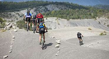
Grande Traversée VTT La TransVerdon - EN
"The TransVerdon begins at the source of the Verdon, at the Col d'Allos, 2,247 m above sea level. It's a 260 km journey between these Alpine mountains and Gréoux-les-Bains, resolutely complete and technical, punctuated by well-deserved swimming breaks.
See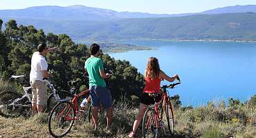
Circuit vélo - Les Gorges du Verdon
Travel the south of the Verdon Gorges from Comps-sur-Artuby passing through the heights of Lake Sainte-Croix which offer beautiful views!
See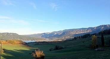
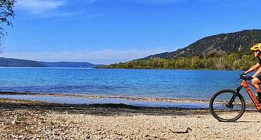
Parcours VTT Aiguines - Les Salles-sur-Verdon
Starting from Aiguines, this trail gives you access to Lake Sainte-Croix and the village of Les Salles-sur-Verdon. Ideal to enjoy the heritage of Aiguines by mountain bike!
See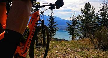
N°1 Vert - Le Lac de Sainte-Croix depuis Moustiers (Circuit VTT Moustiers-Sainte-Marie) - EN
↔ 10 km ↓↑ D+ 96 m X 912393.55 - Y 1879200.63 From the parking lot at the entrance to Moustiers-Saint-Marie, descend onto a small tarmac track, cross the ford, and follow the GR4 to Petit Lac.
See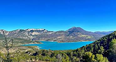
N°2 Bleu - Le Circuit des Lavandes (Circuit VTT Moustiers-Sainte-Marie) - EN
↔ 10.5 km ↓↑ D+ 104 m X 910190.07 , Y 1873347.52 Route VCn°3 between Moustiers-Ste-Marie and the village of Sainte-Croix. 500 m after the ferme du Serre, roadside derelict with view of Lac de Ste-Croix.
See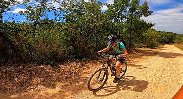
N°3 Bleu - Le balcons du lac de Sainte-Croix (Circuit VTT Moustiers-Sainte-Marie) - EN
↔ 15 km ↓↑ D+ 92 m X 910190.07 - Y 1873347.52 Route VCn°3 between Moustiers-Ste-Marie and the village of Sainte-Croix. 500 m after the ferme du Serre, roadside derelict with view of the Lac de Ste-Croix.
See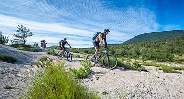
Tour de Barbin - EN
After a rural start along the Brusquet ravine, this loop passes over the Col de la Croix, from where a long climb begins along the Vénarelle forest track, under the pines and then in the shade of a magnificent beech forest.
See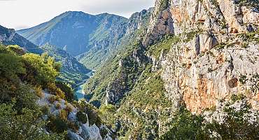
Tour du Verdon à vélo
Lovers of roaming and adventure, ride the Tour du Verdon by bike! Travel in a unique territory: wide outdoors, stunning panoramas and iconic villages.
See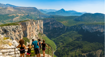
La Route des Crêtes - EN
This 24 km panoramic route in La Palud sur Verdon takes you on a tour of the Grand Canyon ridges. The 14 Belvederes reveal the mythical cliffs of the Verdon and offer unforgettable views of the Grand Canyon.
See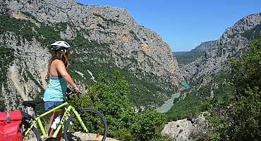
Grand Canyon
Adventure from the depths of the Gorges du Verdon to the Crêtes road and its many viewpoints, cycling circuit from Moustiers-Sainte-Marie to La Palud-sur-Verdon.
See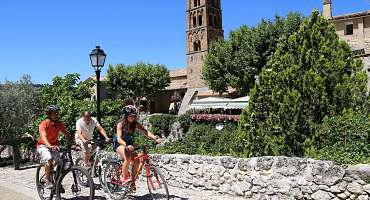
La Romaine
Sports leisure in Verdon, cycling tour in search of the rich territorial past, through the remains of eras. Journey into the history of Provence.
SeeContact & informations
Tourist Information Office of Aiguines
1, Place de la Mairie
83630 Aiguines
Call us
Write us
Visit our website
Add to favorites
Discover our free and easy to access tool to create your bike route in just a few clicks!
Create your bike route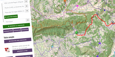


Order your free brochure
Discover our editions of the Luberon south side to prepare your weekend and holidays: guide, accommodation, hiking...
Order