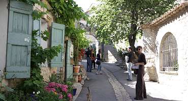
Tourist Information Office of Reillanne
Tourism Information Office in Reillanne. Discover landscapes in Haute Provence and Pays de Banon. Help in the design of your holiday: activities, accommodation...


The Tourist Office can satisfy your requests for tourist information about the municipality of Reillane and inform you about the tourist service providers and bike tours of the Luberon Regional Natural Park.
It collects information on events, leisure activities, walks on the municipality and its surroundings.. It has at your disposal: topoguides, 11 hiking cards around the village, Guides cycling or horseback riding around Reillanne and its region, Bed and Breakfast Guides, tourist documentation of the sites to visit, agenda of Reillanne with useful numbers... The Office organizes events throughout the year:
- Loops Reillannaises Thursday of Ascension
- Cultural outings with a bus departure from Reillanne for concerts and shows (Aix en Provence, La Roque d'Anthéron, Marseille...)
- Conferences
- 2 or 3 empty attics in summer
- Cultural tours for groups with Hélène Novaresio, speaker guide (Arles, Avignon, St Remy de Provence)...
We will be happy to welcome you to make you discover our region and make you enjoy your holiday to the fullest. Also, do not hesitate to contact us by email, by phone or to visit us, Dominique remains at your disposal to answer your questions.
Downloads

Picture gallery


Itinéraire Gravel n°20 - D'une rive à l'autre du Calavon - EN
As its name suggests, this itinerary will take you through the various massifs surrounding the Calavon, as well as charming little villages between Vaucluse and Alpes de Haute-Provence!
See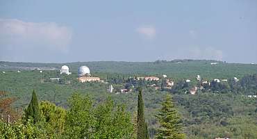
GT VTT L'Alpes Provence - Tronçon 17 - Forcalquier à Saint-Michel L'Observatoire
A section of the Grande Traversée VTT L'Alpes Provence that allows you to discover the Luberon and its hilly landscapes inspiring many artists.
See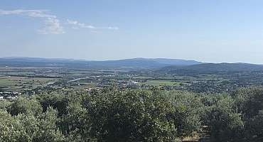
GT VTT L'Alpes Provence - Tronçon 18 - Saint-Michel L'Observatoire à Manosque
Last stretch of the Alpes-Provence Mountain Bike GT on tracks and small roads, this route allows you to savor the entire mountain bike route traveled from the pastures of the Col de Larche.
See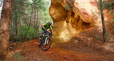
GTV VTT Etape 7 - De Saint-Saturnin-les-Apt à Vitrolles-en-Luberon
This stretch, without great difficulty, is nonetheless a highlight of this Grande Traverée VTT, with passages through the famous ocher massifs of the Luberon.
See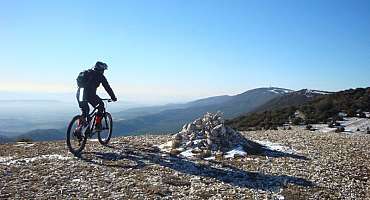
Circuit VTT n°56 - Crêtes du Grand Luberon et Combe Platte
After a beautiful and long climb on the road fortunately covered, the climb on the ridges of the Grand Luberon is quieter and allows you to enjoy several views.
See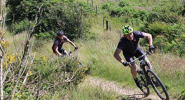
Liaison Grande Traversée de Vaucluse - L'Alpes Provence
This unmarked mountain bike route allows you to join two major mountain bike routes: the Grande Traversée de Vaucluse and the Alpes Provence.
See
Autour du Luberon à vélo
A bike tour for lovers of roaming around the Luberon massif. Signposted in both directions, you travel through the landscapes and typical villages of Provence.
See
Forcalquier - Lure à vélo
Bike route leading you to the wildest corner of the Luberon but also very famous for its purest sky in Europe in Saint-Michel-l'Observatoire.
See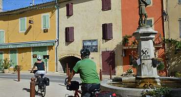
La Méditerranée à vélo en Luberon : Apt - Manosque
This stage of the Mediterranean by bike (EV8) travels the east of the Luberon between Apt and Manosque, from Ochres to the Pays de Forcalquier. A feast for the eyes according to the landscapes!
See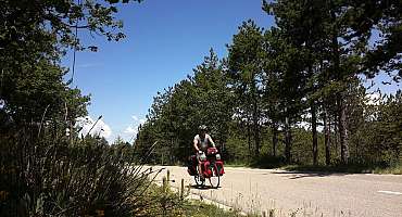
Parcours n°10 - Céreste
A bike ride in the Alps of Haute-Provence combining exceptional natural spaces, crossings of small villages and city discoveries.
See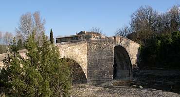
Parcours n°11 - Céreste
A bike ride around the Caseneuve plateau with a crossing of oak woods, lavender fields and cereal tinted in the poppy red season.
See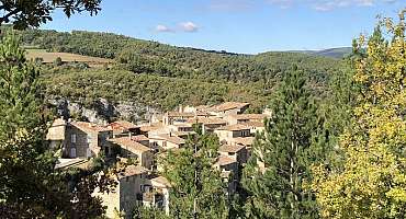
Parcours n°12 - Céreste
Bike ride on the Caseneuve plateau! Possibility of walking in the Oppedette Gorge: a canyon from 100 m to 150 m deep and 2.5 km long.
See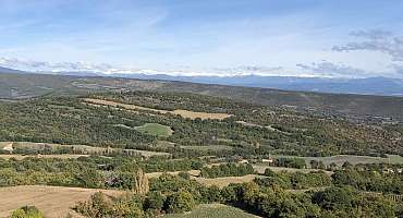
Parcours n°13 - Aubenas-les-Alpes
Discover the villages and landscapes typical of the Pays de Haute-Provence through vast fields of lavender, plateaus, ridges and rolling hills.
See
Parcours n°14 - Aubenas-les-Alpes
A great bike tour in the heart of the Pays de Forcalquier among the fields of lavender and poppies while crossing small villages that have preserved their charms.
See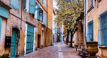
Parcours n°20 - Manosque
A bike ride in the Alps of Haute-Provence combining exceptional natural spaces, crossings of small villages and city discoveries.
See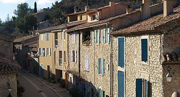
Parcours n°23 - Vitrolles-en-Luberon
Walk in the heights of the Luberon, at the edge of the ridges. During your holidays, a bike getaway in the Pays d'Aigues to observe Provence with height.
See
Parcours n°24 - Vitrolles-en-Luberon
Head to the Grand Luberon, a bike ride at the Vitrolles-en-Luberon pass to discover the hilly landscapes and the valley of the Pays d'Aigues. A trip to Provence.
See
Contact & informations
Tourist Information Office of Reillanne
Cours Thierry d'Argenlieu
04110 Reillanne
Call us
Write us
Visit our website
Add to favorites
Discover our free and easy to access tool to create your bike route in just a few clicks!
Create your bike route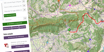


Order your free brochure
Discover our editions of the Luberon south side to prepare your weekend and holidays: guide, accommodation, hiking...
Order