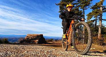
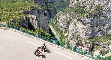
Vous souhaitez louer un vélo à assistance électrique pour découvrir les plus beaux itinéraires du Verdon ? Noël vous accueille et vous conseille à Moustiers-Sainte-Marie.
mis à jour le 31/10/2023 par Velo Loisir Provence
Langues parlées :
Situé à Moustiers-Sainte-Marie , à la sortie du village, direction Castellane , Ebikemoustiers vous propose la location de VAE haut de gamme (cannondale avec motorisation Bosh). Nouveau en 2024 : Le cannondale tesoro neo (batterie Bosch 625 wh moteur bosch performance) et le cannondale trail neo (batterie Bosch 625 wh moteur bosch performance) vous promettent des virées d'exception dans le Verdon ! De 80 km à 150 km d'autonomie !
Vous avez la possibilité de louer sur place ou sur votre lieu d'hébergement.
Différentes tailles sont disponibles. Vous pouvez louer de la demi-journée à plusieurs jours. Remorque enfant et siège TCS également disponibles.
Conseils personnalisés par rapport à votre niveau et vos envies. Téléchargement de circuits directement sur votre smartphone.
Service de réparation, d'entretien et de vente de pièces détachées pour tout type de vélos.
Nouveau service : Diagnostic Bosch e-Bike.
Du 01/05 au 03/11/2024 de 9h à 19h.
Tarifs location VAE (Vélo à Assistance Électrique) :
Services
Activités
Langues parlées
Mode de paiement
Galerie photos
array(1) {
["gpx"]=>
array(48) {
[0]=>
array(12) {
["id_Gpx"]=>
string(5) "18064"
["id_Objet"]=>
string(4) "3072"
["idPage"]=>
string(4) "9416"
["idLangue"]=>
string(1) "1"
["title"]=>
string(65) "Espace VTT-FFC Provence Verdon - Itinéraire VTT n°3 Niveau noir"
["ancre"]=>
string(65) "Espace VTT-FFC Provence Verdon - Itinéraire n°3 : Le Grand Tour"
["idImage"]=>
string(4) "8097"
["latitude"]=>
string(7) "5.88583"
["longitude"]=>
string(7) "43.7585"
["description"]=>
string(170) "Circuit VTT n°3 - Niveau noir - Partez à la découverte du grand Tour de l'espace VTT-FFC Provence Verdon. Profitez des plateaux du Haut Var et le plateau de Valensole."
["url"]=>
string(61) "/page/site-vtt-ffc---provence-verdon---itineraire-3+9416.html"
["colorGPX"]=>
string(7) "#3388ff"
}
[1]=>
array(12) {
["id_Gpx"]=>
string(5) "18064"
["id_Objet"]=>
string(4) "3072"
["idPage"]=>
string(4) "9417"
["idLangue"]=>
string(1) "2"
["title"]=>
string(51) "Site VTT FFC - Provence Verdon - Itinéraire 3 - EN"
["ancre"]=>
string(51) "Site VTT FFC - Provence Verdon - Itinéraire 3 - EN"
["idImage"]=>
string(4) "8097"
["latitude"]=>
string(7) "5.88583"
["longitude"]=>
string(7) "43.7585"
["description"]=>
string(48) "Circuit 3 of the FFC Provence Verdon MTB website"
["url"]=>
string(66) "/page/site-vtt-ffc---provence-verdon---itineraire-3---en+9417.html"
["colorGPX"]=>
string(7) "#3388ff"
}
[2]=>
array(12) {
["id_Gpx"]=>
string(5) "18064"
["id_Objet"]=>
string(4) "3072"
["idPage"]=>
string(4) "9418"
["idLangue"]=>
string(1) "3"
["title"]=>
string(51) "MTB-FFC-Bereich Provence Verdon - MTB-Strecke Nr. 3"
["ancre"]=>
string(62) "Provence Verdon MTB-FFC Bereich - Reiseroute 3: Die Grand Tour"
["idImage"]=>
string(4) "8097"
["latitude"]=>
string(7) "5.88583"
["longitude"]=>
string(7) "43.7585"
["description"]=>
string(171) "Entdecken Sie die Mountainbike-Rennstrecke Nr. 3 - Black - Die Grand Tour durch die MTB-FFC Provence Verdon. Genießen Sie die Haut-Var-Plateaus und das Valensole-Plateau."
["url"]=>
string(66) "/page/site-vtt-ffc---provence-verdon---itineraire-3---de+9418.html"
["colorGPX"]=>
string(7) "#3388ff"
}
[3]=>
array(12) {
["id_Gpx"]=>
string(4) "7269"
["id_Objet"]=>
string(4) "3069"
["idPage"]=>
string(4) "9407"
["idLangue"]=>
string(1) "1"
["title"]=>
string(53) "Espace VTT-FFC Provence Verdon - Itinéraire VTT n°5"
["ancre"]=>
string(49) "Espace VTT-FFC Provence Verdon - Itinéraire n°5"
["idImage"]=>
string(4) "8094"
["latitude"]=>
string(7) "5.88583"
["longitude"]=>
string(7) "43.7585"
["description"]=>
string(170) "Partez à la découverte du circuit VTT n°5 - Rouge de l'espace VTT-FFC Provence Verdon. Profitez de nombreux points de vue sur les plateaux du Haut Var et de Valensole."
["url"]=>
string(61) "/page/site-vtt-ffc---provence-verdon---itineraire-5+9407.html"
["colorGPX"]=>
string(7) "#3388ff"
}
[4]=>
array(12) {
["id_Gpx"]=>
string(4) "7269"
["id_Objet"]=>
string(4) "3069"
["idPage"]=>
string(4) "9408"
["idLangue"]=>
string(1) "2"
["title"]=>
string(51) "Site VTT FFC - Provence Verdon - Itinéraire 5 - EN"
["ancre"]=>
string(51) "Site VTT FFC - Provence Verdon - Itinéraire 5 - EN"
["idImage"]=>
string(4) "8094"
["latitude"]=>
string(7) "5.88583"
["longitude"]=>
string(7) "43.7585"
["description"]=>
string(39) "FFC Provence Verdon MTB website circuit"
["url"]=>
string(66) "/page/site-vtt-ffc---provence-verdon---itineraire-5---en+9408.html"
["colorGPX"]=>
string(7) "#3388ff"
}
[5]=>
array(12) {
["id_Gpx"]=>
string(4) "7269"
["id_Objet"]=>
string(4) "3069"
["idPage"]=>
string(4) "9409"
["idLangue"]=>
string(1) "3"
["title"]=>
string(53) "MTB-FFC Bereich Provence Verdon - MTB-Reiseroute n°5"
["ancre"]=>
string(46) "MTB-FFC Provence Verdon Bereich - Reiseroute 5"
["idImage"]=>
string(4) "8094"
["latitude"]=>
string(7) "5.88583"
["longitude"]=>
string(7) "43.7585"
["description"]=>
string(166) "Entdecken Sie die Mountainbike-Rennstrecke Nr. 5 - Red des MTB-FFC Provence Verdon. Genießen Sie viele Aussichtspunkte auf den Hochebenen von Haut Var und Valensole."
["url"]=>
string(66) "/page/site-vtt-ffc---provence-verdon---itineraire-5---de+9409.html"
["colorGPX"]=>
string(7) "#3388ff"
}
[6]=>
array(12) {
["id_Gpx"]=>
string(4) "1520"
["id_Objet"]=>
string(4) "3051"
["idPage"]=>
string(4) "9353"
["idLangue"]=>
string(1) "1"
["title"]=>
string(54) "Espace VTT-FFC Provence Verdon - Itinéraire VTT n°22"
["ancre"]=>
string(50) "Espace VTT-FFC Provence Verdon - Itinéraire n°22"
["idImage"]=>
string(4) "8076"
["latitude"]=>
string(7) "6.09185"
["longitude"]=>
string(7) "43.8171"
["description"]=>
string(161) "Circuit VTT n°22 - Niveau bleu - Partez à la découverte de l'espace VTT-FFC Provence Verdon. Profitez de nombreux points de vue tout au long de l'itinéraire."
["url"]=>
string(62) "/page/site-vtt-ffc---provence-verdon---itineraire-22+9353.html"
["colorGPX"]=>
string(7) "#3388ff"
}
[7]=>
array(12) {
["id_Gpx"]=>
string(4) "1520"
["id_Objet"]=>
string(4) "3051"
["idPage"]=>
string(4) "9354"
["idLangue"]=>
string(1) "2"
["title"]=>
string(52) "Site VTT FFC - Provence Verdon - Itinéraire 22 - EN"
["ancre"]=>
string(52) "Site VTT FFC - Provence Verdon - Itinéraire 22 - EN"
["idImage"]=>
string(4) "8076"
["latitude"]=>
string(7) "6.09185"
["longitude"]=>
string(7) "43.8171"
["description"]=>
string(64) "Circuit 22 "Les Cabanons" on the FFC Provence Verdon MTB website"
["url"]=>
string(67) "/page/site-vtt-ffc---provence-verdon---itineraire-22---en+9354.html"
["colorGPX"]=>
string(7) "#3388ff"
}
[8]=>
array(12) {
["id_Gpx"]=>
string(4) "1520"
["id_Objet"]=>
string(4) "3051"
["idPage"]=>
string(4) "9355"
["idLangue"]=>
string(1) "3"
["title"]=>
string(51) "MTB-FFC-Bereich Provence Verdon - MTB-Strecke n°22"
["ancre"]=>
string(42) "MTB-FFC Provence Verdon Bereich - Route 22"
["idImage"]=>
string(4) "8076"
["latitude"]=>
string(7) "6.09185"
["longitude"]=>
string(7) "43.8171"
["description"]=>
string(154) "Entdecken Sie die Mountainbike-Rennstrecke Nr. 22 - Bleu des MTB-FFC-Gebietes Provence Verdon. Genießen Sie zahlreiche Aussichtspunkte entlang der Route."
["url"]=>
string(67) "/page/site-vtt-ffc---provence-verdon---itineraire-22---de+9355.html"
["colorGPX"]=>
string(7) "#3388ff"
}
[9]=>
array(12) {
["id_Gpx"]=>
string(4) "1539"
["id_Objet"]=>
string(4) "3070"
["idPage"]=>
string(4) "9410"
["idLangue"]=>
string(1) "1"
["title"]=>
string(53) "Espace VTT-FFC Provence Verdon - Itinéraire VTT n°4"
["ancre"]=>
string(49) "Espace VTT-FFC Provence Verdon - Itinéraire n°4"
["idImage"]=>
string(4) "8095"
["latitude"]=>
string(7) "5.88583"
["longitude"]=>
string(7) "43.7585"
["description"]=>
string(169) "Partez à la découverte du circuit VTT n°4 - bleu de l'espace VTT-FFC Provence Verdon. Au départ des communes de Riez et Roumoules profitez de nombreux points de vue."
["url"]=>
string(61) "/page/site-vtt-ffc---provence-verdon---itineraire-4+9410.html"
["colorGPX"]=>
string(7) "#3388ff"
}
[10]=>
array(12) {
["id_Gpx"]=>
string(4) "1539"
["id_Objet"]=>
string(4) "3070"
["idPage"]=>
string(4) "9411"
["idLangue"]=>
string(1) "2"
["title"]=>
string(51) "Site VTT FFC - Provence Verdon - Itinéraire 4 - EN"
["ancre"]=>
string(51) "Site VTT FFC - Provence Verdon - Itinéraire 4 - EN"
["idImage"]=>
string(4) "8095"
["latitude"]=>
string(7) "5.88583"
["longitude"]=>
string(7) "43.7585"
["description"]=>
string(0) ""
["url"]=>
string(66) "/page/site-vtt-ffc---provence-verdon---itineraire-4---en+9411.html"
["colorGPX"]=>
string(7) "#3388ff"
}
[11]=>
array(12) {
["id_Gpx"]=>
string(4) "1539"
["id_Objet"]=>
string(4) "3070"
["idPage"]=>
string(4) "9412"
["idLangue"]=>
string(1) "3"
["title"]=>
string(53) "MTB-FFC Bereich Provence Verdon - MTB-Reiseroute n°4"
["ancre"]=>
string(38) "MTB-FFC Provence Verdon - Reiseroute 4"
["idImage"]=>
string(4) "8095"
["latitude"]=>
string(7) "5.88583"
["longitude"]=>
string(7) "43.7585"
["description"]=>
string(168) "Entdecken Sie die Mountainbike-Rennstrecke Nr. 4 - blau der MTB-FFC Provence Verdon. Ausgehend von den Gemeinden Riez und Roumoules genießen Sie viele Aussichtspunkte."
["url"]=>
string(66) "/page/site-vtt-ffc---provence-verdon---itineraire-4---de+9412.html"
["colorGPX"]=>
string(7) "#3388ff"
}
[12]=>
array(12) {
["id_Gpx"]=>
string(4) "1540"
["id_Objet"]=>
string(4) "3071"
["idPage"]=>
string(4) "9413"
["idLangue"]=>
string(1) "1"
["title"]=>
string(54) "Espace VTT-FFC Provence Verdon - Itinéraire VTT n°4 "
["ancre"]=>
string(49) "Espace VTT-FFC Provence Verdon - Itinéraire n°4"
["idImage"]=>
string(4) "8096"
["latitude"]=>
string(7) "6.09334"
["longitude"]=>
string(7) "43.8174"
["description"]=>
string(152) "Circuit VTT n°4 - Niveau bleu - Partez à la découverte de l'espace VTT-FFC Provence Verdon. Mettez vous en selle pour parcourir 15km dans le verdon !"
["url"]=>
string(61) "/page/site-vtt-ffc---provence-verdon---itineraire-4+9413.html"
["colorGPX"]=>
string(7) "#3388ff"
}
[13]=>
array(12) {
["id_Gpx"]=>
string(4) "1540"
["id_Objet"]=>
string(4) "3071"
["idPage"]=>
string(4) "9414"
["idLangue"]=>
string(1) "2"
["title"]=>
string(51) "Site VTT FFC - Provence Verdon - Itinéraire 4 - EN"
["ancre"]=>
string(51) "Site VTT FFC - Provence Verdon - Itinéraire 4 - EN"
["idImage"]=>
string(4) "8096"
["latitude"]=>
string(7) "6.09334"
["longitude"]=>
string(7) "43.8174"
["description"]=>
string(48) "Circuit 4 of the FFC Provence Verdon MTB website"
["url"]=>
string(66) "/page/site-vtt-ffc---provence-verdon---itineraire-4---en+9414.html"
["colorGPX"]=>
string(7) "#3388ff"
}
[14]=>
array(12) {
["id_Gpx"]=>
string(4) "1540"
["id_Objet"]=>
string(4) "3071"
["idPage"]=>
string(4) "9415"
["idLangue"]=>
string(1) "3"
["title"]=>
string(53) "MTB-FFC Bereich Provence Verdon - MTB-Reiseroute n°4"
["ancre"]=>
string(38) "MTB-FFC Provence Verdon - Reiseroute 4"
["idImage"]=>
string(4) "8096"
["latitude"]=>
string(7) "6.09334"
["longitude"]=>
string(7) "43.8174"
["description"]=>
string(142) "Entdecken Sie die Mountainbike-Rennstrecke Nr. 4 - Bleu der MTB-FFC Provence Verdon. Steigen Sie in den Sattel und fahren Sie 15 km im Verdon!"
["url"]=>
string(66) "/page/site-vtt-ffc---provence-verdon---itineraire-4---de+9415.html"
["colorGPX"]=>
string(7) "#3388ff"
}
[15]=>
array(12) {
["id_Gpx"]=>
string(4) "1537"
["id_Objet"]=>
string(4) "3068"
["idPage"]=>
string(4) "9404"
["idLangue"]=>
string(1) "1"
["title"]=>
string(53) "Espace VTT-FFC Provence Verdon - Itinéraire VTT n°5"
["ancre"]=>
string(49) "Espace VTT-FFC Provence Verdon - Itinéraire n°5"
["idImage"]=>
string(4) "8093"
["latitude"]=>
string(7) "5.88583"
["longitude"]=>
string(7) "43.7585"
["description"]=>
string(170) "Partez à la découverte du circuit VTT n°5 - Rouge de l'espace VTT-FFC Provence Verdon. Profitez de nombreux points de vue sur les plateaux du Haut Var et de Valensole."
["url"]=>
string(61) "/page/site-vtt-ffc---provence-verdon---itineraire-5+9404.html"
["colorGPX"]=>
string(7) "#3388ff"
}
[16]=>
array(12) {
["id_Gpx"]=>
string(4) "1537"
["id_Objet"]=>
string(4) "3068"
["idPage"]=>
string(4) "9405"
["idLangue"]=>
string(1) "2"
["title"]=>
string(51) "Site VTT FFC - Provence Verdon - Itinéraire 5 - EN"
["ancre"]=>
string(51) "Site VTT FFC - Provence Verdon - Itinéraire 5 - EN"
["idImage"]=>
string(4) "8093"
["latitude"]=>
string(7) "5.88583"
["longitude"]=>
string(7) "43.7585"
["description"]=>
string(0) ""
["url"]=>
string(66) "/page/site-vtt-ffc---provence-verdon---itineraire-5---en+9405.html"
["colorGPX"]=>
string(7) "#3388ff"
}
[17]=>
array(12) {
["id_Gpx"]=>
string(4) "1537"
["id_Objet"]=>
string(4) "3068"
["idPage"]=>
string(4) "9406"
["idLangue"]=>
string(1) "3"
["title"]=>
string(53) "MTB-FFC Bereich Provence Verdon - MTB-Reiseroute n°5"
["ancre"]=>
string(46) "MTB-FFC Provence Verdon Bereich - Reiseroute 5"
["idImage"]=>
string(4) "8093"
["latitude"]=>
string(7) "5.88583"
["longitude"]=>
string(7) "43.7585"
["description"]=>
string(166) "Entdecken Sie die Mountainbike-Rennstrecke Nr. 5 - Red des MTB-FFC Provence Verdon. Genießen Sie viele Aussichtspunkte auf den Hochebenen von Haut Var und Valensole."
["url"]=>
string(66) "/page/site-vtt-ffc---provence-verdon---itineraire-5---de+9406.html"
["colorGPX"]=>
string(7) "#3388ff"
}
[18]=>
array(12) {
["id_Gpx"]=>
string(5) "13997"
["id_Objet"]=>
string(4) "5648"
["idPage"]=>
string(5) "17191"
["idLangue"]=>
string(1) "1"
["title"]=>
string(69) "Itinéraire VTT dans le Verdon - Électrique : Les contreforts du Lac"
["ancre"]=>
string(88) "Espace VTT-FFC FFCT Provence Alpes - Électrique - Les contreforts du Lac - Niveau Bleu "
["idImage"]=>
string(5) "15601"
["latitude"]=>
string(7) "6.22222"
["longitude"]=>
string(7) "43.8472"
["description"]=>
string(184) "↔ 14,5 km ↓↑ D+ 352 m
X 912393.55 - Y 1879200.63
Au départ du parking à l’entrée de Moustiers-Sainte-Marie, prendre la montée goudronnée (surnommée la 16%) sur 3 km."
["url"]=>
string(94) "/page/electrique-bleu---les-contreforts-du-lac-(circuit-vtt-moustiers-sainte-marie)+17191.html"
["colorGPX"]=>
string(7) "#3388ff"
}
[19]=>
array(12) {
["id_Gpx"]=>
string(5) "13997"
["id_Objet"]=>
string(4) "5648"
["idPage"]=>
string(5) "17192"
["idLangue"]=>
string(1) "2"
["title"]=>
string(83) "Électrique Bleu - Les contreforts du Lac (Circuit VTT Moustiers-Sainte-Marie) - EN"
["ancre"]=>
string(83) "Électrique Bleu - Les contreforts du Lac (Circuit VTT Moustiers-Sainte-Marie) - EN"
["idImage"]=>
string(5) "15601"
["latitude"]=>
string(7) "6.22222"
["longitude"]=>
string(7) "43.8472"
["description"]=>
string(176) "↔ 14.5 km ↓↑ D+ 352 m
X 912393.55 - Y 1879200.63
From the parking lot at the entrance to Moustiers-Sainte-Marie, take the asphalt climb (nicknamed the 16%) for 3 km."
["url"]=>
string(99) "/page/electrique-bleu---les-contreforts-du-lac-(circuit-vtt-moustiers-sainte-marie)---en+17192.html"
["colorGPX"]=>
string(7) "#3388ff"
}
[20]=>
array(12) {
["id_Gpx"]=>
string(5) "13997"
["id_Objet"]=>
string(4) "5648"
["idPage"]=>
string(5) "17193"
["idLangue"]=>
string(1) "3"
["title"]=>
string(83) "Électrique Bleu - Les contreforts du Lac (Circuit VTT Moustiers-Sainte-Marie) - DE"
["ancre"]=>
string(83) "Électrique Bleu - Les contreforts du Lac (Circuit VTT Moustiers-Sainte-Marie) - DE"
["idImage"]=>
string(5) "15601"
["latitude"]=>
string(7) "6.22222"
["longitude"]=>
string(7) "43.8472"
["description"]=>
string(0) ""
["url"]=>
string(99) "/page/electrique-bleu---les-contreforts-du-lac-(circuit-vtt-moustiers-sainte-marie)---de+17193.html"
["colorGPX"]=>
string(7) "#3388ff"
}
[21]=>
array(12) {
["id_Gpx"]=>
string(5) "13973"
["id_Objet"]=>
string(4) "5629"
["idPage"]=>
string(5) "17158"
["idLangue"]=>
string(1) "1"
["title"]=>
string(69) "Itinéraire VTT dans le Verdon - Électrique - Le Moulin de Mourresse"
["ancre"]=>
string(89) "Espace VTT-FFC FFCT Provence Alpes - Électrique - Le Moulin de Mourresse - Niveau Rouge "
["idImage"]=>
string(5) "15582"
["latitude"]=>
string(7) "6.22222"
["longitude"]=>
string(7) "43.8472"
["description"]=>
string(124) "Au départ du parking à l’entrée de Moustiers Sainte-Marie, prendre la montée goudronnée (surnommée la 16%) sur 3 km."
["url"]=>
string(95) "/page/electrique-rouge---le-moulin-de-mourresse-(circuit-vtt-moustiers-sainte-marie)+17158.html"
["colorGPX"]=>
string(7) "#3388ff"
}
[22]=>
array(12) {
["id_Gpx"]=>
string(5) "13973"
["id_Objet"]=>
string(4) "5629"
["idPage"]=>
string(5) "17159"
["idLangue"]=>
string(1) "2"
["title"]=>
string(84) "Électrique Rouge - Le Moulin de Mourresse (Circuit VTT Moustiers-Sainte-Marie) - EN"
["ancre"]=>
string(84) "Électrique Rouge - Le Moulin de Mourresse (Circuit VTT Moustiers-Sainte-Marie) - EN"
["idImage"]=>
string(5) "15582"
["latitude"]=>
string(7) "6.22222"
["longitude"]=>
string(7) "43.8472"
["description"]=>
string(174) "↔ 21 km ↓↑ D+ 768 m
X 912393.55 - Y 1879200.63
From the parking lot at the entrance to Moustiers-Sainte-Marie, take the asphalt climb (nicknamed the 16%) for 3 km."
["url"]=>
string(100) "/page/electrique-rouge---le-moulin-de-mourresse-(circuit-vtt-moustiers-sainte-marie)---en+17159.html"
["colorGPX"]=>
string(7) "#3388ff"
}
[23]=>
array(12) {
["id_Gpx"]=>
string(5) "13973"
["id_Objet"]=>
string(4) "5629"
["idPage"]=>
string(5) "17160"
["idLangue"]=>
string(1) "3"
["title"]=>
string(84) "Électrique Rouge - Le Moulin de Mourresse (Circuit VTT Moustiers-Sainte-Marie) - DE"
["ancre"]=>
string(84) "Électrique Rouge - Le Moulin de Mourresse (Circuit VTT Moustiers-Sainte-Marie) - DE"
["idImage"]=>
string(5) "15582"
["latitude"]=>
string(7) "6.22222"
["longitude"]=>
string(7) "43.8472"
["description"]=>
string(0) ""
["url"]=>
string(100) "/page/electrique-rouge---le-moulin-de-mourresse-(circuit-vtt-moustiers-sainte-marie)---de+17160.html"
["colorGPX"]=>
string(7) "#3388ff"
}
[24]=>
array(12) {
["id_Gpx"]=>
string(5) "14031"
["id_Objet"]=>
string(4) "5651"
["idPage"]=>
string(5) "17200"
["idLangue"]=>
string(1) "1"
["title"]=>
string(36) "Grande Traversée VTT La TransVerdon"
["ancre"]=>
string(36) "Grande Traversée VTT La TransVerdon"
["idImage"]=>
string(5) "15613"
["latitude"]=>
string(7) "6.14784"
["longitude"]=>
string(6) "43.764"
["description"]=>
string(267) "« La TransVerdon » débute aux sources du Verdon, au col d’Allos, situé à 2.247 m d’altitude. Il s’agit d’un voyage de 260 km entre ces montagnes alpines et Gréoux-les-Bains, résolument complet et technique, ponctué de pauses baignades bien méritées."
["url"]=>
string(52) "/page/grande-traversee-vtt-la-transverdon+17200.html"
["colorGPX"]=>
string(7) "#3388ff"
}
[25]=>
array(12) {
["id_Gpx"]=>
string(5) "14031"
["id_Objet"]=>
string(4) "5651"
["idPage"]=>
string(5) "17201"
["idLangue"]=>
string(1) "2"
["title"]=>
string(41) "Grande Traversée VTT La TransVerdon - EN"
["ancre"]=>
string(41) "Grande Traversée VTT La TransVerdon - EN"
["idImage"]=>
string(5) "15613"
["latitude"]=>
string(7) "6.14784"
["longitude"]=>
string(6) "43.764"
["description"]=>
string(253) ""The TransVerdon begins at the source of the Verdon, at the Col d'Allos, 2,247 m above sea level. It's a 260 km journey between these Alpine mountains and Gréoux-les-Bains, resolutely complete and technical, punctuated by well-deserved swimming breaks."
["url"]=>
string(57) "/page/grande-traversee-vtt-la-transverdon---en+17201.html"
["colorGPX"]=>
string(7) "#3388ff"
}
[26]=>
array(12) {
["id_Gpx"]=>
string(5) "14031"
["id_Objet"]=>
string(4) "5651"
["idPage"]=>
string(5) "17202"
["idLangue"]=>
string(1) "3"
["title"]=>
string(41) "Grande Traversée VTT La TransVerdon - DE"
["ancre"]=>
string(41) "Grande Traversée VTT La TransVerdon - DE"
["idImage"]=>
string(5) "15613"
["latitude"]=>
string(7) "6.14784"
["longitude"]=>
string(6) "43.764"
["description"]=>
string(0) ""
["url"]=>
string(57) "/page/grande-traversee-vtt-la-transverdon---de+17202.html"
["colorGPX"]=>
string(7) "#3388ff"
}
[27]=>
array(12) {
["id_Gpx"]=>
string(3) "707"
["id_Objet"]=>
string(4) "1597"
["idPage"]=>
string(4) "4984"
["idLangue"]=>
string(1) "1"
["title"]=>
string(66) "Itinéraire VTT dans le Verdon : Aiguines et les Salles-sur-Verdon"
["ancre"]=>
string(54) "Circuit VTT Verdon : Aiguines - Les Salles-sur-Verdon "
["idImage"]=>
string(4) "2123"
["latitude"]=>
string(7) "6.24097"
["longitude"]=>
string(7) "43.7757"
["description"]=>
string(178) "Au départ d'Aiguines, ce sentier vous permettra d’accéder au lac de Sainte-Croix et au village des Salles-sur-Verdon. Idéal pour profiter du patrimoine d’Aiguines en VTT !"
["url"]=>
string(49) "/page/parcours-vtt-les-salles-sur-verdon-aiguines"
["colorGPX"]=>
string(7) "#dc70a9"
}
[28]=>
array(12) {
["id_Gpx"]=>
string(3) "707"
["id_Objet"]=>
string(4) "1597"
["idPage"]=>
string(4) "4985"
["idLangue"]=>
string(1) "2"
["title"]=>
string(62) "Mountain bike route between Aiguines and the Salles-sur-Verdon"
["ancre"]=>
string(45) "Parcours VTT Aiguines - Les Salles-sur-Verdon"
["idImage"]=>
string(4) "2123"
["latitude"]=>
string(7) "6.24097"
["longitude"]=>
string(7) "43.7757"
["description"]=>
string(172) "Starting from Aiguines, this trail gives you access to Lake Sainte-Croix and the village of Les Salles-sur-Verdon. Ideal to enjoy the heritage of Aiguines by mountain bike!"
["url"]=>
string(51) "/page/parcours-vtt--vers-les-salles----en+4985.html"
["colorGPX"]=>
string(7) "#dc70a9"
}
[29]=>
array(12) {
["id_Gpx"]=>
string(3) "707"
["id_Objet"]=>
string(4) "1597"
["idPage"]=>
string(4) "4986"
["idLangue"]=>
string(1) "3"
["title"]=>
string(62) "Mountainbike-Route zwischen Aiguines und Les Salles-sur-Verdon"
["ancre"]=>
string(45) "Parcours VTT Aiguines - Les Salles-sur-Verdon"
["idImage"]=>
string(4) "2123"
["latitude"]=>
string(7) "6.24097"
["longitude"]=>
string(7) "43.7757"
["description"]=>
string(175) "Ausgehend von Aiguines ermöglicht Ihnen dieser Weg den See Sainte-Croix und das Dorf Les Salles-sur-Verdon. Ideal, um das Erbe von Aiguines mit dem Mountainbike zu genießen!"
["url"]=>
string(51) "/page/parcours-vtt--vers-les-salles----de+4986.html"
["colorGPX"]=>
string(7) "#dc70a9"
}
[30]=>
array(12) {
["id_Gpx"]=>
string(5) "13929"
["id_Objet"]=>
string(4) "5609"
["idPage"]=>
string(5) "17102"
["idLangue"]=>
string(1) "2"
["title"]=>
string(93) "N°1 Vert - Le Lac de Sainte-Croix depuis Moustiers (Circuit VTT Moustiers-Sainte-Marie) - EN"
["ancre"]=>
string(93) "N°1 Vert - Le Lac de Sainte-Croix depuis Moustiers (Circuit VTT Moustiers-Sainte-Marie) - EN"
["idImage"]=>
string(5) "15575"
["latitude"]=>
string(7) "6.22222"
["longitude"]=>
string(7) "43.8472"
["description"]=>
string(203) "↔ 10 km ↓↑ D+ 96 m
X 912393.55 - Y 1879200.63
From the parking lot at the entrance to Moustiers-Saint-Marie, descend onto a small tarmac track, cross the ford, and follow the GR4 to Petit Lac."
["url"]=>
string(108) "/page/n1-vert---le-lac-de-sainte-croix-depuis-moustiers-(circuit-vtt-moustiers-sainte-marie)---en+17102.html"
["colorGPX"]=>
string(7) "#3388ff"
}
[31]=>
array(12) {
["id_Gpx"]=>
string(5) "13929"
["id_Objet"]=>
string(4) "5609"
["idPage"]=>
string(5) "17101"
["idLangue"]=>
string(1) "1"
["title"]=>
string(100) "Itinéraire VTT dans le Verdon - Circuit n°1 : Le Lac de Sainte-Croix depuis Moustiers Sainte-Marie"
["ancre"]=>
string(101) "Espace VTT-FFC FFCT Provence Alpes - Circuit n°1 : Le Lac de Sainte-Croix depuis Moustiers - Niveau "
["idImage"]=>
string(5) "15575"
["latitude"]=>
string(7) "6.22222"
["longitude"]=>
string(7) "43.8472"
["description"]=>
string(173) "Au départ du parking à l’entrée de Moustiers-Saint-Marie, descendre sur un petit chemin goudronné, traverser le passage à gué, et suivre le GR4 jusqu’au Petit Lac."
["url"]=>
string(103) "/page/n1-vert---le-lac-de-sainte-croix-depuis-moustiers-(circuit-vtt-moustiers-sainte-marie)+17101.html"
["colorGPX"]=>
string(7) "#3388ff"
}
[32]=>
array(12) {
["id_Gpx"]=>
string(5) "13929"
["id_Objet"]=>
string(4) "5609"
["idPage"]=>
string(5) "17103"
["idLangue"]=>
string(1) "3"
["title"]=>
string(93) "N°1 Vert - Le Lac de Sainte-Croix depuis Moustiers (Circuit VTT Moustiers-Sainte-Marie) - DE"
["ancre"]=>
string(93) "N°1 Vert - Le Lac de Sainte-Croix depuis Moustiers (Circuit VTT Moustiers-Sainte-Marie) - DE"
["idImage"]=>
string(5) "15575"
["latitude"]=>
string(7) "6.22222"
["longitude"]=>
string(7) "43.8472"
["description"]=>
string(0) ""
["url"]=>
string(108) "/page/n1-vert---le-lac-de-sainte-croix-depuis-moustiers-(circuit-vtt-moustiers-sainte-marie)---de+17103.html"
["colorGPX"]=>
string(7) "#3388ff"
}
[33]=>
array(12) {
["id_Gpx"]=>
string(5) "13998"
["id_Objet"]=>
string(4) "5649"
["idPage"]=>
string(5) "17194"
["idLangue"]=>
string(1) "1"
["title"]=>
string(72) "Itinéraire VTT dans le Verdon - Circuit n°2 : Le Circuit des Lavandes "
["ancre"]=>
string(90) "Espace VTT-FFC FFCT Provence Alpes - Circuit n°2 : Le Circuit des Lavandes - Niveau Bleu "
["idImage"]=>
string(5) "15603"
["latitude"]=>
string(7) "6.22222"
["longitude"]=>
string(7) "43.8472"
["description"]=>
string(170) "Route VC n°3 entre Moustiers-Ste-Marie et le village de Sainte-Croix. 500 m après la ferme du Serre, délaissé bord de route avec point de vue sur le lac de Ste-Croix."
["url"]=>
string(87) "/page/n2-bleu---le-circuit-des-lavandes-(circuit-vtt-moustiers-sainte-marie)+17194.html"
["colorGPX"]=>
string(7) "#3388ff"
}
[34]=>
array(12) {
["id_Gpx"]=>
string(5) "13998"
["id_Objet"]=>
string(4) "5649"
["idPage"]=>
string(5) "17195"
["idLangue"]=>
string(1) "2"
["title"]=>
string(77) "N°2 Bleu - Le Circuit des Lavandes (Circuit VTT Moustiers-Sainte-Marie) - EN"
["ancre"]=>
string(77) "N°2 Bleu - Le Circuit des Lavandes (Circuit VTT Moustiers-Sainte-Marie) - EN"
["idImage"]=>
string(5) "15603"
["latitude"]=>
string(7) "6.22222"
["longitude"]=>
string(7) "43.8472"
["description"]=>
string(214) "↔ 10.5 km ↓↑ D+ 104 m
X 910190.07 , Y 1873347.52
Route VCn°3 between Moustiers-Ste-Marie and the village of Sainte-Croix. 500 m after the ferme du Serre, roadside derelict with view of Lac de Ste-Croix."
["url"]=>
string(92) "/page/n2-bleu---le-circuit-des-lavandes-(circuit-vtt-moustiers-sainte-marie)---en+17195.html"
["colorGPX"]=>
string(7) "#3388ff"
}
[35]=>
array(12) {
["id_Gpx"]=>
string(5) "13998"
["id_Objet"]=>
string(4) "5649"
["idPage"]=>
string(5) "17196"
["idLangue"]=>
string(1) "3"
["title"]=>
string(77) "N°2 Bleu - Le Circuit des Lavandes (Circuit VTT Moustiers-Sainte-Marie) - DE"
["ancre"]=>
string(77) "N°2 Bleu - Le Circuit des Lavandes (Circuit VTT Moustiers-Sainte-Marie) - DE"
["idImage"]=>
string(5) "15603"
["latitude"]=>
string(7) "6.22222"
["longitude"]=>
string(7) "43.8472"
["description"]=>
string(0) ""
["url"]=>
string(92) "/page/n2-bleu---le-circuit-des-lavandes-(circuit-vtt-moustiers-sainte-marie)---de+17196.html"
["colorGPX"]=>
string(7) "#3388ff"
}
[36]=>
array(12) {
["id_Gpx"]=>
string(5) "13917"
["id_Objet"]=>
string(4) "5599"
["idPage"]=>
string(5) "17072"
["idLangue"]=>
string(1) "2"
["title"]=>
string(87) "N°3 Bleu - Le balcons du lac de Sainte-Croix (Circuit VTT Moustiers-Sainte-Marie) - EN"
["ancre"]=>
string(87) "N°3 Bleu - Le balcons du lac de Sainte-Croix (Circuit VTT Moustiers-Sainte-Marie) - EN"
["idImage"]=>
string(5) "15563"
["latitude"]=>
string(7) "6.22222"
["longitude"]=>
string(7) "43.8472"
["description"]=>
string(215) "↔ 15 km ↓↑ D+ 92 m
X 910190.07 - Y 1873347.52
Route VCn°3 between Moustiers-Ste-Marie and the village of Sainte-Croix. 500 m after the ferme du Serre, roadside derelict with view of the Lac de Ste-Croix."
["url"]=>
string(102) "/page/n3-bleu---le-balcons-du-lac-de-sainte-croix-(circuit-vtt-moustiers-sainte-marie)---en+17072.html"
["colorGPX"]=>
string(7) "#3388ff"
}
[37]=>
array(12) {
["id_Gpx"]=>
string(5) "13917"
["id_Objet"]=>
string(4) "5599"
["idPage"]=>
string(5) "17071"
["idLangue"]=>
string(1) "1"
["title"]=>
string(82) "Itinéraire VTT dans le Verdon - Circuit n°3 : Les balcons du lac de Sainte-Croix"
["ancre"]=>
string(101) "Espace VTT-FFC FFCT Provence Alpes - Circuit n°3 : Les balcons du lac de Sainte-Croix - Niveau Bleu "
["idImage"]=>
string(5) "15563"
["latitude"]=>
string(7) "6.22222"
["longitude"]=>
string(7) "43.8472"
["description"]=>
string(176) "Route VC n°3 entre Moustiers Sainte-Marie et le village de Sainte-Croix. 500 m après la ferme du Serre, délaissé bord de route avec point de vue sur le lac de Sainte-Croix."
["url"]=>
string(97) "/page/n3-bleu---le-balcons-du-lac-de-sainte-croix-(circuit-vtt-moustiers-sainte-marie)+17071.html"
["colorGPX"]=>
string(7) "#3388ff"
}
[38]=>
array(12) {
["id_Gpx"]=>
string(5) "13917"
["id_Objet"]=>
string(4) "5599"
["idPage"]=>
string(5) "17073"
["idLangue"]=>
string(1) "3"
["title"]=>
string(87) "N°3 Bleu - Le balcons du lac de Sainte-Croix (Circuit VTT Moustiers-Sainte-Marie) - DE"
["ancre"]=>
string(87) "N°3 Bleu - Le balcons du lac de Sainte-Croix (Circuit VTT Moustiers-Sainte-Marie) - DE"
["idImage"]=>
string(5) "15563"
["latitude"]=>
string(7) "6.22222"
["longitude"]=>
string(7) "43.8472"
["description"]=>
string(0) ""
["url"]=>
string(102) "/page/n3-bleu---le-balcons-du-lac-de-sainte-croix-(circuit-vtt-moustiers-sainte-marie)---de+17073.html"
["colorGPX"]=>
string(7) "#3388ff"
}
[39]=>
array(12) {
["id_Gpx"]=>
string(5) "13941"
["id_Objet"]=>
string(4) "5619"
["idPage"]=>
string(5) "17131"
["idLangue"]=>
string(1) "1"
["title"]=>
string(67) "Itinéraire VTT dans le Verdon - Circuit n°4 : La Saint-Jursienne "
["ancre"]=>
string(85) "Espace VTT-FFC FFCT Provence Alpes - Circuit n°4 : La Saint-Jursienne - Niveau Rouge"
["idImage"]=>
string(5) "15579"
["latitude"]=>
string(7) "6.22222"
["longitude"]=>
string(7) "43.8472"
["description"]=>
string(90) "Au départ du petit village de Saint-Jurs, montée par une piste dans la forêt domaniale."
["url"]=>
string(83) "/page/n4-rouge---la-saint-jursienne-(circuit-vtt-moustiers-sainte-marie)+17131.html"
["colorGPX"]=>
string(7) "#3388ff"
}
[40]=>
array(12) {
["id_Gpx"]=>
string(5) "13941"
["id_Objet"]=>
string(4) "5619"
["idPage"]=>
string(5) "17133"
["idLangue"]=>
string(1) "3"
["title"]=>
string(73) "N°4 Rouge - La Saint-Jursienne (Circuit VTT Moustiers-Sainte-Marie) - DE"
["ancre"]=>
string(73) "N°4 Rouge - La Saint-Jursienne (Circuit VTT Moustiers-Sainte-Marie) - DE"
["idImage"]=>
string(5) "15579"
["latitude"]=>
string(7) "6.22222"
["longitude"]=>
string(7) "43.8472"
["description"]=>
string(0) ""
["url"]=>
string(88) "/page/n4-rouge---la-saint-jursienne-(circuit-vtt-moustiers-sainte-marie)---de+17133.html"
["colorGPX"]=>
string(7) "#3388ff"
}
[41]=>
array(12) {
["id_Gpx"]=>
string(5) "13941"
["id_Objet"]=>
string(4) "5619"
["idPage"]=>
string(5) "17132"
["idLangue"]=>
string(1) "2"
["title"]=>
string(73) "N°4 Rouge - La Saint-Jursienne (Circuit VTT Moustiers-Sainte-Marie) - EN"
["ancre"]=>
string(73) "N°4 Rouge - La Saint-Jursienne (Circuit VTT Moustiers-Sainte-Marie) - EN"
["idImage"]=>
string(5) "15579"
["latitude"]=>
string(7) "6.22222"
["longitude"]=>
string(7) "43.8472"
["description"]=>
string(145) "↔ 25.5 km ↓↑ D+ 1034 m
X 910558.78 - Y 1873347.52
Starting from the small village of Saint-Jurs, climb up a track in the state forest."
["url"]=>
string(88) "/page/n4-rouge---la-saint-jursienne-(circuit-vtt-moustiers-sainte-marie)---en+17132.html"
["colorGPX"]=>
string(7) "#3388ff"
}
[42]=>
array(12) {
["id_Gpx"]=>
string(5) "13985"
["id_Objet"]=>
string(4) "5638"
["idPage"]=>
string(5) "17190"
["idLangue"]=>
string(1) "3"
["title"]=>
string(67) "N°5 Noir - Le Montdenier (Circuit VTT Moustiers-Sainte-Marie) - DE"
["ancre"]=>
string(67) "N°5 Noir - Le Montdenier (Circuit VTT Moustiers-Sainte-Marie) - DE"
["idImage"]=>
string(5) "15595"
["latitude"]=>
string(7) "6.22222"
["longitude"]=>
string(7) "43.8472"
["description"]=>
string(0) ""
["url"]=>
string(82) "/page/n5-noir---le-montdenier-(circuit-vtt-moustiers-sainte-marie)---de+17190.html"
["colorGPX"]=>
string(7) "#3388ff"
}
[43]=>
array(12) {
["id_Gpx"]=>
string(5) "13985"
["id_Objet"]=>
string(4) "5638"
["idPage"]=>
string(5) "17189"
["idLangue"]=>
string(1) "2"
["title"]=>
string(67) "N°5 Noir - Le Montdenier (Circuit VTT Moustiers-Sainte-Marie) - EN"
["ancre"]=>
string(67) "N°5 Noir - Le Montdenier (Circuit VTT Moustiers-Sainte-Marie) - EN"
["idImage"]=>
string(5) "15595"
["latitude"]=>
string(7) "6.22222"
["longitude"]=>
string(7) "43.8472"
["description"]=>
string(224) "↔ 35 km ↓↑ D+ 1430 m
X 912393.55 - Y 1879200.63
Starting from the parking lot at the entrance to Moustiers-Sainte-Marie, head for the village center through the typical narrow streets of this characterful village."
["url"]=>
string(82) "/page/n5-noir---le-montdenier-(circuit-vtt-moustiers-sainte-marie)---en+17189.html"
["colorGPX"]=>
string(7) "#3388ff"
}
[44]=>
array(12) {
["id_Gpx"]=>
string(5) "13985"
["id_Objet"]=>
string(4) "5638"
["idPage"]=>
string(5) "17188"
["idLangue"]=>
string(1) "1"
["title"]=>
string(62) "Itinéraire VTT dans le Verdon - Circuit n°5 : Le Montdenier "
["ancre"]=>
string(79) "Espace VTT-FFC FFCT Provence Alpes - Circuit n°5 : Le Montdenier - Niveau Noir"
["idImage"]=>
string(5) "15595"
["latitude"]=>
string(7) "6.22222"
["longitude"]=>
string(7) "43.8472"
["description"]=>
string(215) "↔ 35 km ↓↑ D+ 1430 m
X 912393.55 - Y 1879200.63
Au départ du parking à l’entrée de Moustiers-Sainte-Marie, dirigez-vous vers le centre du village par les ruelles typiques de ce village de caractère."
["url"]=>
string(77) "/page/n5-noir---le-montdenier-(circuit-vtt-moustiers-sainte-marie)+17188.html"
["colorGPX"]=>
string(7) "#3388ff"
}
[45]=>
array(12) {
["id_Gpx"]=>
string(5) "18250"
["id_Objet"]=>
string(3) "861"
["idPage"]=>
string(4) "2759"
["idLangue"]=>
string(1) "1"
["title"]=>
string(62) "Tour du Verdon à vélo - Balade et découverte en itinérance"
["ancre"]=>
string(23) "Tour du Verdon à vélo"
["idImage"]=>
string(5) "16005"
["latitude"]=>
string(6) "5.8847"
["longitude"]=>
string(6) "43.758"
["description"]=>
string(177) "Amateurs d'itinérance et d'aventure, parcourez le Tour du Verdon à vélo ! Voyagez en territoire unique : grands espaces, panoramas époustouflants et villages emblématiques."
["url"]=>
string(27) "/page/tour-du-verdon-a-velo"
["colorGPX"]=>
string(7) "#000000"
}
[46]=>
array(12) {
["id_Gpx"]=>
string(5) "18250"
["id_Objet"]=>
string(3) "861"
["idPage"]=>
string(4) "2760"
["idLangue"]=>
string(1) "2"
["title"]=>
string(51) "Tour du Verdon by bike - Roaming tour and discovery"
["ancre"]=>
string(23) "Tour du Verdon à vélo"
["idImage"]=>
string(4) "1756"
["latitude"]=>
string(6) "5.8847"
["longitude"]=>
string(6) "43.758"
["description"]=>
string(150) "Lovers of roaming and adventure, ride the Tour du Verdon by bike! Travel in a unique territory: wide outdoors, stunning panoramas and iconic villages."
["url"]=>
string(42) "/page/tour-du-verdon-a-velo---en+2760.html"
["colorGPX"]=>
string(7) "#000000"
}
[47]=>
array(12) {
["id_Gpx"]=>
string(5) "18250"
["id_Objet"]=>
string(3) "861"
["idPage"]=>
string(4) "2761"
["idLangue"]=>
string(1) "3"
["title"]=>
string(76) "Tour durch das Verdon mit dem Fahrrad - Spazieren und Entdecken beim Roaming"
["ancre"]=>
string(23) "Tour du Verdon à vélo"
["idImage"]=>
string(4) "2047"
["latitude"]=>
string(6) "5.8847"
["longitude"]=>
string(6) "43.758"
["description"]=>
string(200) "Liebhaber von Roaming und Abenteuer können die Tour du Verdon mit dem Fahrrad fahren! Reisen Sie in einem einzigartigen Gebiet: weite Freiflächen, atemberaubende Panoramen und emblematische Dörfer."
["url"]=>
string(42) "/page/tour-du-verdon-a-velo---de+2761.html"
["colorGPX"]=>
string(7) "#000000"
}
}
}
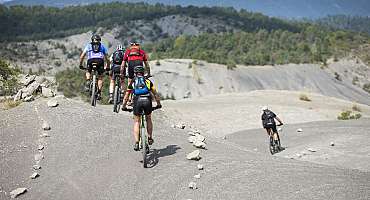
Grande Traversée VTT La TransVerdon « La TransVerdon » débute aux sources du Verdon, au col d’Allos, situé à 2.247 m d’altitude. Il s’agit d’un voyage de 260 km entre ces montagnes alpines et Gréoux-les-Bains, résolument complet et technique, ponctué de pauses baignades bien méritées.
Voir
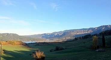
Tour du Verdon à vélo Amateurs d'itinérance et d'aventure, parcourez le Tour du Verdon à vélo ! Voyagez en territoire unique : grands espaces, panoramas époustouflants et villages emblématiques.
Voir